GEOPARK INTRODUCTION
Keketuohai UNESCO Global Geopark is located in the Altay Region of Yili Prefecture in Xinjiang, China, spanning Fuyun County and Qinghe County, 33 kilometers from the Fuyun county seat. With Kaladuergen River in the north, Kalaxiangeer in the south, Kalagezeng in the west, and Kalazhuole and Tayite in the east, it ranges in elevation from 1072 to 3234 meters and occupies an area of 2337.90 square kilometers. The Geopark is comprised by Irtysh Gorge, No. 3 Mine, Sayihengbulake, Kekesuli and Kalaxiangeer. It is world-renowned for its typical granite-pegmatite rare metals deposits and mine site, unique Altai Mountain granite landforms, traces of the Fuyun Earthquake, and the Irtysh River’s beautiful desert scenery. Keketuohai Geopark was listed as a National Geopark in 2005 and National 5A-level Scenic Area in 2012. In 2017, Keketuohai officially joined the Global Geoparks Network and became the 35th UNESCO Global Geopark in China. It is therefore known as China's "Yosemite".
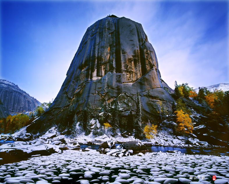
Holy Bell Peak(Bell-shaped Granite Landform)
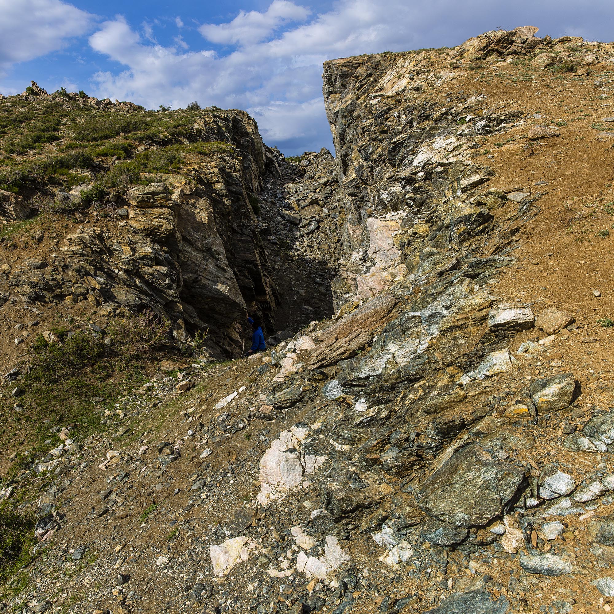
Kalaxiangeer Earthquake Tension Crack

No. 3 Mine
Holy Bell Peak(Bell-shaped Granite Landform)
Kalaxiangeer Earthquake Tension Crack
No. 3 Mine